 Connexion
 Field-Map en mots-clés – ce qui distingue Field-Map
<< précédentSupport of external measurement devices (GPS, laser rangefinder, compass, angle encoder, inclinometer, caliper, field computer)
Field-Map provides for smooth communication between field computer and external measurement devices.
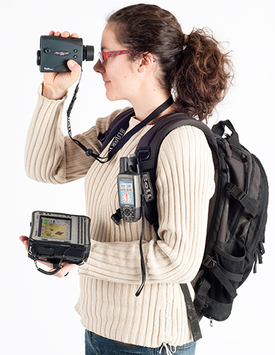
For three dimensional mapping of –for example- forest ecosystems, Field-Map may use a set composed by the following devices:
For three dimensional mapping of –for example- forest ecosystems, Field-Map may use a set composed by the following devices:
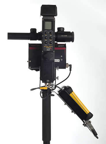
- A laser range finder, which combined with an electronic inclinometer and compass are used for distance measurement and for determining vertical and horizontal angles. Horizontal angles are expressed directly as azimuths.
- An electronic calliper, which is used for measuring tree diameters.
- A GPS, which may be used for georeferencing the measurements.
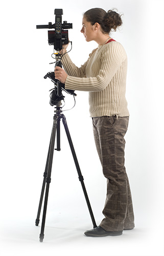
The entire set of equipment can be mounted on a monopod or tripod suitable for the fieldwork.
Si vous souhaitez plus d'information n'hésitez pas contactez-nous.