 Login
Login Field-Map Data Collector (FMDC)
-
Continuous georeferencing
A set of temporary reference points measured by laser range-finder and marked by reference poles, can be established in the field. It allows the user to move freely within the study area without losing the georeference of the actual measurement point.
-
User extensions
It is possible to easily connect user defined modules and extended functions (e.g. volume tables).
-
Repeated measurements
A forest inventory is typically repeated after some period of time. In the second round the trees must be identified and remeasured. There is a number of functions related to the repeated measurements included in FMDC, e.g. identification of the trees by coordinates, on-line checking of the previously measured values, etc.
-
Transects
Transect (profile diagram) is a virtual line in the forest showing the profiles of trees and tree crowns. You can choose to color tree species, reduce the number of visualized trees by reducing distance from the transect line, etc. Picture of the transect can be exported for use in your reports.
-
Tree heights
There are 5 modes for tree height measurement and 2 modes for slanted tree measurement. You can choose the optimal one depending on the required accuracy, the desired measurement speed and the local measurement conditions.
-
Remote diameter measurement
Using a special optical scope combined with laser range-finder you can measure stem or branch diameters in upper parts of the tree.
-
Various size and shape of plots
You can choose size and shape of sample plots directly in the field or predefine it in the office.
-
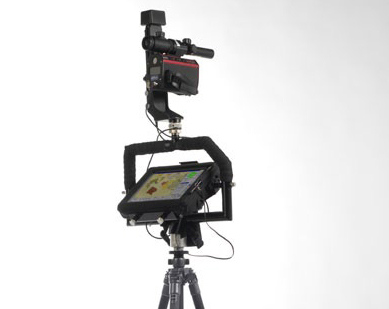
Support of electronic devices
A number of measurement devices can communicate with the FMDC application. These devices can be connected via cable, Bluetooth or radio signal. Typical devices working with FMDC are laser rangefinder with electronic compass or electronic tachymeter, GPS or electronic caliper.
-
Segments and concentric circles
FMDC supports division of the plot into several concentric circles. For each circle, you can define a threshold diameter to be measured.
-
Coordinate systems
Support for conversion between coordinate systems.
-
Background digital maps
FMDC can display background maps containing vector and/or raster formats.
-
GIS functions
Other functions for working with maps include: create parallel line, create buffer, create grid, offset line, union polygons, etc.